 Case studies
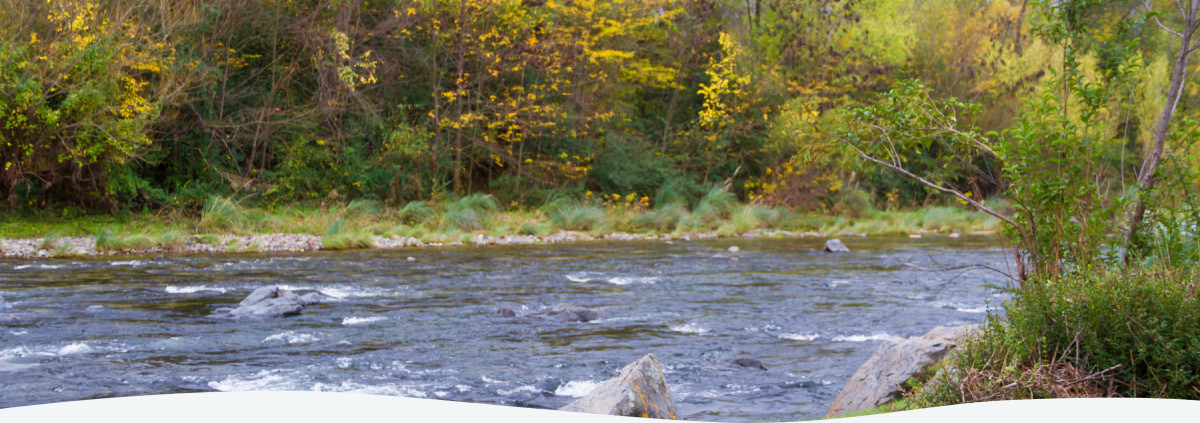
The Pillahuinco basin is located in one of the most productive regions of Argentina. The major problem in the basin is surface water erosion causing a loss of soil productivity in the upper catchment of the basin. Therefore, there was a need to design a planning program aimed to reduce soil loss by surface water erosion and thus increase soil productivity, strengthening the hydrological dynamics in the Pillahuinco basin.
Background
The Pillahuinco basin is located in one of the most productive regions of Argentina. It is within the roads that connect the southernmost parts of the country with the capital and the far north, as well as the Andean provinces of the west with the ports of the Atlantic coast, intersect there. The basin covers a region with a distinct topography, presenting a highland area with elevations between 250 and 650 meters. With a plain that can reach about 125 meters where agricultural activities predominate. The agriculture activities have resulted to environmental problems calling for an approach that can provide solutions to support sustainable development of the basin.
In Pillahuinco basin, economic growth has been historically associated with agricultural and livestock production. Agricultural production accounts for 50% of the production in the district. The main crops grown are wheat, soybean, barley, sunflower, sorghum and maize. 70% of the production is exported.
Human activities in Pillahuinco basin resulted to a number of issues that arise from irrational use of natural resources. Loss of soil productivity and degradation, erosion, floods, desertification, water eutrophication, destruction of forests and loss of biodiversity have become evident in the basin. These problems make living conditions difficult for residents of the basin forcing many to migrate to big cities in search of better life.
Actions taken
A collaboration among the residents of the basin was initiated to address soil loss through surface water erosion. Indicators were developed that identified the everyday use and management values through involvement of stakeholders in the basin. The approach enabled easy interpretation and provided a basis for comparative analysis of every resource user. Thus, consensus and the support of the basin stakeholders with diverse representation from private sector, political, institutional and social background was cemented. The implementation of this program highlighted a case in rural planning that has contributed to the improvement of the quality of life of the rural and urban communities.
In addition, quantification and modelling of water resources was done through the application of geographic information systems. It was crucial so as to assess the availability of the current and future resources as well as analysis of land use changes. The end product is a geospatial database available and open to public access. Finally, a sustainable use of water resources and Rural Planning for the basin was proposed based on potential alternative production systems. The proposal has taken into account the needs of the local population and the implementation of Land Use Planning that can be achieved through integrated water resources management.
In order to reduce the magnitude and intensity of erosion in the basin soil management measures were implemented. These include soil water management techniques such as strip cropping and contour farming, use of terraces in areas with important slopes. More so, reduction of the number of animals per hectare, placement of drinking troughs for livestock to prevent animals traveling to river banks.
Outcomes
In order to achieve the proposed goals, an agreement was signed between the National University of La Plata and the municipality of Coronel Pringles. The agreement acted as a basis for commitment from different institutions to collaborate with rural planning at basin level. It included the Rural Society of Coronel Pringles, Producers Association, Road cooperative and centre of Agronomists. Institutional mechanisms for collaboration and coordination with municipalities were established, which entail the resolution of issues closely related to the management of water resources, such as recurring flooding of the urban centre of Coronel Pringles.
Coronel Pringles joined the Intermunicipal Consortium for Regional Development (CIDERE), which recently inaugurated the Regional Development Agency (ADR). It aims to promote strategic sector alliances, coordinate public and private efforts to foster development in the region, promotion of cooperation and employment generation as well as social, economic and environmental sustainability.
Lessons Learned
The sustainable use of water resources and rural planning in basin was an important experience for IWRM. It involved different stakeholders in basin, implementing sustainable farming practices that aim to address surface water erosion, and to recover productivity of soil.
The joint action of the project participants (researchers, producers, public and private institutions as well as other stakeholders) made it possible to collect field data on biological, productive, environmental and social features of the basin under study.


